Climbing Cerro Soray in Peru’s Vilcabamba Mountain Range 5546m
Although Cerro Soray isn’t the highest or most technically demanding peak in the Vilcabamba range, it offers a five-star ★★★★★ adventure that serves well as either a main objective for beginner climbers or a warm-up before tackling bigger mountains in the Cusco region, such as Nevado Ausangate.
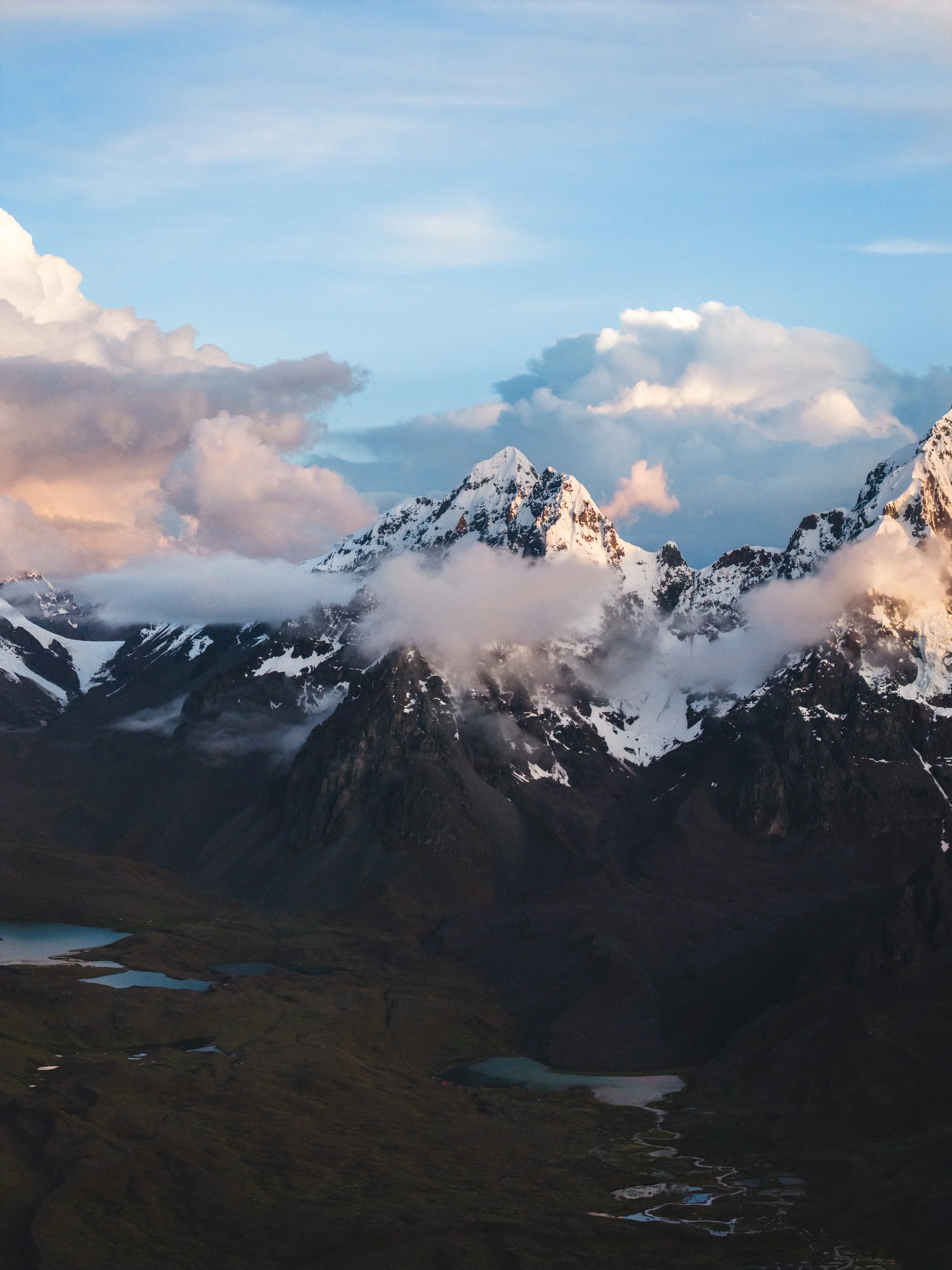
It’s June 23rd, and I’m starting to feel in mid-season form. After the last few climbs, I’ve finished each one with energy to spare, still craving something more. At this point, 18,000ft feels like sea level. Imagine that! About a week ago, on June 14th, 2025, my Cusqueño friend Franklin and I left our homes at 5 a.m. for the small village of Soraypampa to climb Cerro Soray. The drive itself is part of the reward of doing this climb. On clear mornings, the sun lights up the sublime southeast face of Apu Nevado Salkantay in a soft orange glow. And no matter how many times I see it, the view will never get old. After a quick breakfast buffet in Mollepata, we drove for another hour before stopping about a kilometer short of the village. A massive landslide four months earlier had destroyed part of the road. Fortunately, the walk from there was mostly flat, and our relatively lightweight packs made the added distance feel like nothing.
Being in Soraypampa, amongst the glaciated giants of Tucarhuay and Salkantay, felt incredibly full-circle for me. Back in 2022, I came to Peru with one of my best friends to hike the Salkantay Trek, which shares a trailhead with this climb. At 24, I never imagined I’d end up living and working here full-time. Standing at that trailhead again felt like returning to the place that changed the entire course of my life. As we started the hike, I took a moment to appreciate what a privilege it was to be back again and to call this beautiful country my home. After about four hours of walking, we reached base camp at 4,740 meters (15,551 feet). Confident that the route would be straightforward, we left behind all technical gear at home; no ropes, harnesses, or snow stakes. Each of us carried just a single basic piolet and a pair of crampons. We soon regretted that decision, because instead of following the normal route, we mistakenly climbed, and later downclimbed, a more difficult line that consisted of a 6 meter, 5.9 rock chimney followed by 30 meters of exposed M2 to M3 mixed terrain.
From the base camp, we hiked an hour up an easy dirt moraine to reach the first glacier at the bottom of a talus field. I’d read online that this talus was awful, but that seemed exaggerated. By moving slowly and steadily, we found large rocks frozen in the dirt and made it up without much trouble. The real issue came at the top of the talus, where we made a critical route-finding mistake. The online guide described a “10-foot, class 4 chimney with minimal exposure,” marked by a chockstone, after which we were supposed to continue up a crack to the second glacier. I misread the description and assumed that the chockstone would appear right at the start of the rock section at the top of the talus field. Instead of moving up and right along the standard route, we followed a more direct line up a large crack with a chockstone that led us straight to the second glacier.
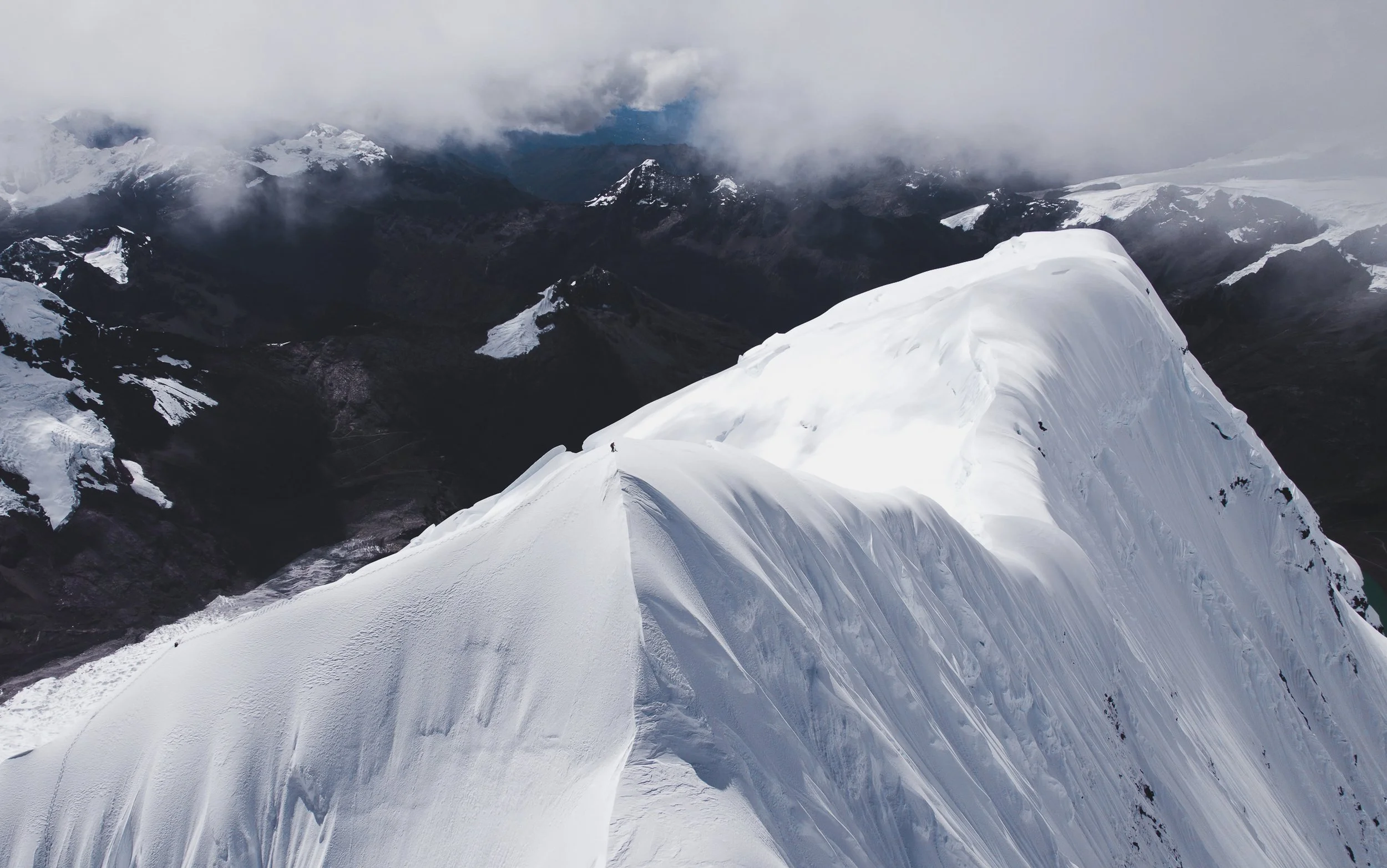
Franklin soloed the chimney first. Once above it, we put on our crampons, and I led the next 30 meters of mixed terrain. It was a combination of snow-ice features, rock walls, scree, and thin water ice over smooth rock. When we finally topped out on the glacier, I looked over at Franklin in disbelief. “This is supposed to be beginner-friendly?” I asked. “And how hell are we getting back down that without a rope?” That was a problem for later. From there, we cruised up to the summit on firm snow, and the views were spectacular on all sides. On the descent, we debated searching for a different route but ultimately chose to downclimb the same crack, not knowing what else lay below. In hindsight, it was a poor choice. A few days later, I returned to climb the mountain again and found the standard route, an easy, non-technical rock traverse to the second glacier. Franklin led the way down. During the downclimb, my nerves were a bit stressed. I was relieved to finally reach solid ground. If the climbing had been even slightly more difficult, I would’ve gladly spent an hour or more looking for an alternate way down.
Despite what could have been a misadventure, we made it down safely and without major issues. The experience pushed our mental limits more than anything. As my friend Dane says, here’s to tagging the summit, getting back safely, and staying friends through it all.
After you climb Cerro Soray, another objective to level up your skills is Nevado Mariposa in the Vilcanota mountain range near Pacchanta, about 4 hours from Cusco.
Media gallery by Matt Stacy / Andes Adventure Visuals